
Why real-time radar matters in 2026
Weather radar is no longer just a weather app feature; it is a primary safety tool. In 2026, the gap between professional meteorological data and consumer access has closed. Real-time storm tracking allows homeowners and storm chasers to see precipitation intensity, wind velocity, and storm movement with near-instantaneous latency. This immediacy transforms a weather forecast from a passive observation into an active decision-making tool.
The foundation of this data remains the National Weather Service’s NEXRAD network. These government-grade Doppler radars provide the raw reflectivity and velocity data that power most consumer applications. However, NEXRAD data is not always available in real-time to the public. Standard government feeds often suffer from latency issues, with updates delayed by 10 to 20 minutes depending on network traffic and processing queues. For a fast-moving tornado or a rapidly intensifying squall line, that delay is critical.
Consumer-grade real-time radar apps bridge this gap. By ingesting raw NEXRAD data and applying proprietary compression and interpolation algorithms, these tools deliver updates every 30 to 60 seconds. This speed allows users to track storm cells as they develop, rather than reacting to where they were half an hour ago. The difference between a 20-minute delay and real-time tracking is the difference between watching a storm approach and seeing it strike.
This shift has democratized storm tracking. While professional meteorologists rely on complex, high-latency models for long-range forecasting, individuals now have access to the same underlying data streams, just accelerated. Choosing a radar app with low-latency performance is therefore not just about convenience; it is about having the most current view of a dynamic, potentially dangerous environment.
Top weather radar apps for storm tracking
The best weather radar apps for 2026 share a common foundation: they all pull from the same NEXRAD network. The difference lies in how they process that raw data and present it to you. A good storm tracking app should offer low-latency updates, accurate precipitation intensity, and a clear interface that doesn't clutter the screen with unnecessary noise.
We evaluated the leading options based on three criteria: data speed, alert accuracy, and visual clarity. The goal is to find software that gets out of your way when you need to see the storm, then alerts you effectively when you need to act.
The Comparison
Here is how the top contenders stack up against each other regarding latency, alert types, and data sources.
| App | Update Latency | Alert Types | Data Source |
|---|---|---|---|
| Radar | < 2 mins | Severe & Flash Flood | NEXRAD |
| Clime | < 1 min | Severe & Air Quality | NEXRAD + EPA |
| Weather Underground | 2-3 mins | Severe & Tropical | NEXRAD + Personal Stations |
Radar
Radar remains a staple for many storm chasers and casual users alike. Its interface is clean, focusing on a large, easy-to-read map. The app provides updates every two minutes, which is sufficient for most non-chasing scenarios. It integrates well with other digital tools, making it a solid choice for those who want a no-frills experience. The alerts are reliable for severe weather, though they lack the granularity of some specialized tools.
Clime
Clime takes a radar-first approach, prioritizing speed and accuracy. It offers updates in under a minute, giving you a significant edge when storms are moving quickly. Beyond standard weather alerts, Clime also integrates air quality data, which is useful for tracking smoke from wildfires or pollen counts. This makes it a versatile tool for those who need more than just rain and wind data. The interface is slightly more technical but remains intuitive.
Weather Underground
Weather Underground distinguishes itself with its network of personal weather stations. This hyperlocal data can fill in gaps where NEXRAD coverage is sparse. While the update latency is slightly higher than Clime, the added detail can be valuable for backyard-level forecasting. The app is best for users who want a broader picture of their immediate neighborhood. It also offers robust tropical storm tracking, making it a strong option for coastal residents.
Hardware radars for home monitoring
While smartphone apps provide convenience, they rely entirely on cellular networks and the internet. When a severe weather event knocks out power or saturates local cell towers, those apps go dark. For homeowners who need reliable storm tracking during outages, dedicated hardware offers a redundant data stream that operates independently of commercial infrastructure.
Physical weather stations and specialized radar displays bridge this gap. These devices often include local sensors for temperature, humidity, and barometric pressure, but their true value lies in their ability to process radar data or provide hyper-local alerts without an internet connection. Some units feature built-in sirens and large LCD screens that display precipitation intensity in real-time, giving you a visual cue that is harder to ignore than a phone notification.
The trade-off is upfront cost and installation. Unlike free apps, these systems require an initial investment in hardware and, in some cases, a subscription for advanced radar layers. However, for residents in tornado alley or coastal flood zones, the peace of mind provided by a dedicated, offline-capable monitoring system is often worth the expense.
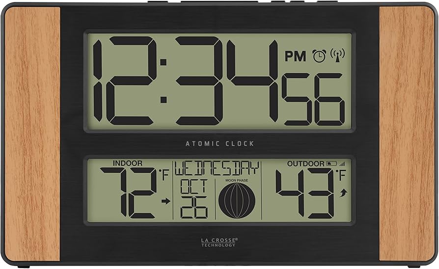
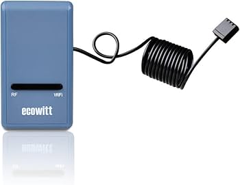
Top home weather monitoring systems
The following products represent the current standard for home-based weather monitoring. They are selected for their reliability, sensor accuracy, and ability to function during connectivity failures.
As an Amazon Associate, we may earn from qualifying purchases.
Choosing radar data for disaster response
When seconds matter, the difference between a clear warning and a missed alert often comes down to data redundancy. Disaster response teams cannot rely on a single feed. If one provider’s tower goes down or suffers latency, a secondary source keeps the picture accurate. This is why professional-grade setups always pair a primary radar network with a backup.
The National Weather Service’s NEXRAD network remains the gold standard for wide-area coverage. Its S-band and WSR-88D radars provide the foundational data for most emergency operations. However, during fast-moving severe weather, local gaps can appear. Supplementing this with commercial or specialized radar apps fills those blind spots.
For field teams, apps like RadarScope or MyRadar offer customizable alert thresholds and layer overlays. These tools allow responders to filter out noise and focus on rotation or heavy precipitation cores. Look for apps that allow offline caching of radar tiles, as cell service often fails during the storms you are tracking.
Redundancy also applies to hardware. A dedicated NOAA Weather Radio with specific alert codes provides an auditory backup if screens go dark. Pairing a visual radar feed with an audio alert system ensures that critical information is received even if attention is diverted to other tasks.
Frequently asked questions about weather radar
How accurate is a home weather radar compared to NEXRAD?
NEXRAD (National Weather Service radar) is the gold standard for coverage, but it has blind spots. Because it sits 70 miles away, the beam spreads out over distance, missing light rain or low-level storms. A home radar like the Clime Weather Radar fills this gap by providing high-resolution, local data that NEXRAD cannot see. Think of NEXRAD as a wide-angle lens and your home radar as a telephoto lens—you need both for a complete picture.
Do weather radar apps actually work, or are they just pretty pictures?
Most free apps only display NEXRAD data, which has a 15-30 minute delay and lower resolution. They are fine for general awareness but unreliable for real-time storm chasing. Apps that integrate with home radar hardware (like Clime or WeatherFlow) show real-time precipitation and storm motion. If you want to know if rain is hitting your driveway in the next five minutes, you need hardware, not just an app.
Is it worth buying a standalone weather radar station?
Yes, if you live in a severe weather corridor. NEXRAD data is free but delayed. A standalone radar provides immediate, hyper-local data on storm intensity and movement. This is critical for homeowners who need to secure property before a storm hits. For casual users who just want to know if they need an umbrella, a standard weather app is sufficient.
No comments yet. Be the first to share your thoughts!